
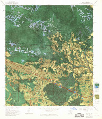
1956 Map of Sargent
USGS Topo · Published 1957About this map
Okefenokee Swamp dominates this mid-century landscape, where the border between Georgia and Florida is defined by the vast wetlands of the Okefenokee National Wildlife Refuge. The map reveals a remote environment of named depressions and water bodies, including White Arm Bay, Moorehead Bay, and Sapp Prairie. Human activity is concentrated along the Southern railroad line, which cuts a straight path through the swampy terrain. Small, isolated outposts like Sargent and Ewing appear as rare points of habitation in an area otherwise characterized by the dense, wet thickets of Pinhook Swamp and Double Run Swamp. The presence of the Watson Line offers a glimpse into historical land surveying and boundary disputes in this difficult-to-navigate terrain during the mid-1950s.
Find a feature on this map
18 named features on this map. Tap any name to fly to it.
Don’t see what you’re looking for? This feature index may not catch every label — zoom into the map to look around manually.
Map Details
Editions of this 1956 Sargent Map
This is the sole edition of this map. No revisions or reprints were ever made.
Other maps of this area

1954 · Valdosta
USGS Topo · 1:250,000

1955 · Council
USGS Topo · 1:24,000

1956 · Eddy
USGS Topo · 1:24,000

1958 · Valdosta
USGS Topo · 1:250,000

1959 · Valdosta
USGS Topo · 1:250,000

1965 · Blackjack Island
USGS Topo · 1:24,000

1967 · Strange Island
USGS Topo · 1:24,000

1967 · Sargent
USGS Topo · 1:24,000
1967 · Eddy
USGS Topo · 1:24,000

1967 · Fargo
USGS Topo · 1:24,000