
1967 Map of Sargent
USGS Topo · Published 1968About this map
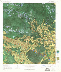
The Georgia-Florida state line bisects this 1967 experimental orthophotomap, where the Okefenokee National Wildlife Refuge dominates the northern landscape. This specialized edition, prepared from 1963 aerial photography and 1967 surveys, provides a clear view of the complex hydrology within the Okefenokee Swamp and Pinhook Swamp. The Southern railroad line cuts a straight path through the wetlands, connecting small points like Sargent, Moorehead, and Traveler.
Find a feature on this map
24 named features on this map. Tap any name to fly to it.
Don’t see what you’re looking for? This feature index may not catch every label — zoom into the map to look around manually.
Map Details
Editions of this 1967 Sargent Map
This is the sole edition of this map. No revisions or reprints were ever made.
Other maps of this area

1954 · Valdosta
USGS Topo · 1:250,000

1955 · Council
USGS Topo · 1:24,000

1956 · Eddy
USGS Topo · 1:24,000

1956 · Sargent
USGS Topo · 1:24,000

1958 · Valdosta
USGS Topo · 1:250,000

1959 · Valdosta
USGS Topo · 1:250,000

1965 · Blackjack Island
USGS Topo · 1:24,000

1967 · Strange Island
USGS Topo · 1:24,000
1967 · Eddy
USGS Topo · 1:24,000

1967 · Fargo
USGS Topo · 1:24,000