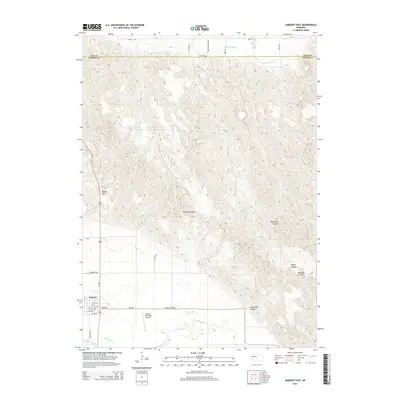
2014 Map of Sargent East
USGS Topo · Published 2014About this map
Sargent anchors the southwestern corner of this Custer County landscape, situated where the high plains break into a complex system of drainage canyons. The town's grid, including Main St and Edith St, sits just north of the Middle Loup River, a vital water source for the region's agricultural irrigation. This reliance on water management is evident in the engineered paths of the Taylor-Ord Canal and Canal Number 2, which skirt the edges of the river valley to support local farming operations.
Find a feature on this map
32 named features on this map. Tap any name to fly to it.
Don’t see what you’re looking for? This feature index may not catch every label — zoom into the map to look around manually.
Map Details
Editions of this 2014 Sargent East Map
This is the sole edition of this map. No revisions or reprints were ever made.
Other maps of this area

1952 · Burwell
USGS Topo · 1:24,000

1952 · Sargent East
USGS Topo · 1:24,000

1952 · Sargent SE
USGS Topo · 1:24,000

1952 · Sargent West
USGS Topo · 1:24,000

1952 · Comstock
USGS Topo · 1:24,000

1952 · Taylor SE
USGS Topo · 1:24,000

1952 · Sargent SW
USGS Topo · 1:24,000

1952 · Comstock NW
USGS Topo · 1:24,000

1952 · Taylor
USGS Topo · 1:24,000

1955 · Broken Bow
USGS Topo · 1:250,000