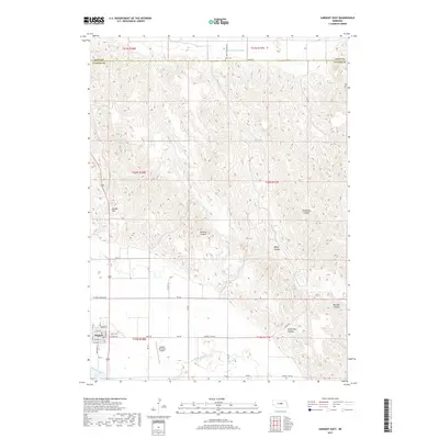
2017 Map of Sargent East
USGS Topo · Published 2017About this map
The Middle Loup River valley anchors this 2017 study of the Custer and Loup county line, where the town of Sargent sits as a regional center. The map reveals an intricate hydraulic system supporting Nebraska agriculture, including the Taylor-Ord Canal and Canal Number 2. Moving north from the river, the landscape transitions into a series of named ravines such as McCord Canyon, Bohys Canyon, and Bromwick Canyon, which drain the higher ground toward the county boundary. Local history and infrastructure are represented by the Sargent Municipal Airport south of town and the Kent Cem located along Kent Rd to the north. The grid of rural roads, including Victoria Springs Rd and Sargent Ord Rd, provides a clear view of how modern transportation corridors follow long-established section lines across this distinctive Nebraska terrain.
Find a feature on this map
48 named features on this map. Tap any name to fly to it.
Don’t see what you’re looking for? This feature index may not catch every label — zoom into the map to look around manually.
Map Details
Editions of this 2017 Sargent East Map
This is the sole edition of this map. No revisions or reprints were ever made.
Other maps of this area

1952 · Burwell
USGS Topo · 1:24,000

1952 · Sargent East
USGS Topo · 1:24,000

1952 · Sargent SE
USGS Topo · 1:24,000

1952 · Sargent West
USGS Topo · 1:24,000

1952 · Comstock
USGS Topo · 1:24,000

1952 · Taylor SE
USGS Topo · 1:24,000

1952 · Sargent SW
USGS Topo · 1:24,000

1952 · Comstock NW
USGS Topo · 1:24,000

1952 · Taylor
USGS Topo · 1:24,000

1955 · Broken Bow
USGS Topo · 1:250,000