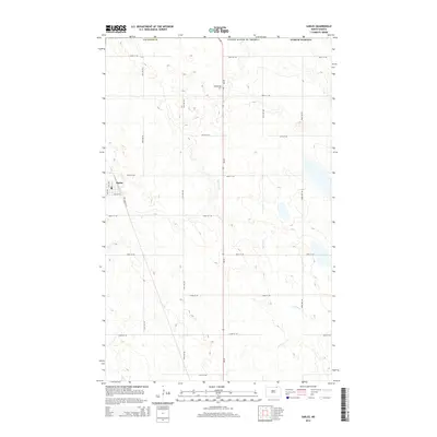
2014 Map of Sarles
USGS Topo · Published 2014About this map
The border community of Sarles serves as the focal point of this North Dakota landscape, situated along the international boundary between United States of America and Canada. The town's grid is anchored by Po and Sawyer St, while the diagonal path of Railroad St E hints at the historical importance of the rail line to this agricultural region. Outside the immediate settlement, the terrain is defined by a sparse network of section-line roads and the winding path of Cypress Cr, which drains the glacial prairie landscape. The presence of Woodbridge Cem to the east of the primary north-south corridor provides a key reference point for local history and genealogical research in this quiet corner of Cavalier Co.
Find a feature on this map
24 named features on this map. Tap any name to fly to it.
Don’t see what you’re looking for? This feature index may not catch every label — zoom into the map to look around manually.
Map Details
Editions of this 2014 Sarles Map
This is the sole edition of this map. No revisions or reprints were ever made.
Other maps of this area

1953 · Devils Lake
USGS Topo · 1:250,000

1956 · Devils Lake
USGS Topo · 1:250,000

1969 · Rock Lake NE
USGS Topo · 1:24,000

1970 · Sarles NE
USGS Topo · 1:24,000

1970 · Calvin
USGS Topo · 1:24,000

1970 · Sarles SE
USGS Topo · 1:24,000

1970 · Sarles
USGS Topo · 1:24,000

1970 · Rock Lake SE
USGS Topo · 1:24,000

1985 · Langdon
USGS Topo · 1:100,000

1985 · Rock Lake
USGS Topo · 1:100,000