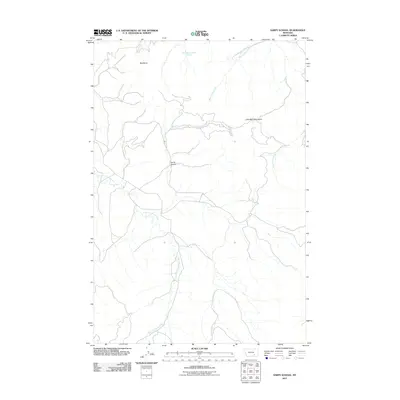
2011 Map of Sarpy School
USGS Topo · Published 2011About this map
The Little Wolf Mountains dominate the eastern landscape of this Rosebud County region, where the terrain is defined by a series of significant drainages and high points. This 2011 survey by the U.S. Geological Survey documents the intricate watershed system of the area, anchored by the winding path of East Fork Sarpy Creek as it moves through the central valley. To the north, Red Butte serves as a prominent navigational landmark, standing near the headwaters of Donley Creek.
Find a feature on this map
8 named features on this map. Tap any name to fly to it.
Don’t see what you’re looking for? This feature index may not catch every label — zoom into the map to look around manually.
Map Details
Editions of this 2011 Sarpy School Map
This is the sole edition of this map. No revisions or reprints were ever made.
Other maps of this area

1954 · Hardin
USGS Topo · 1:250,000

1957 · Hardin
USGS Topo · 1:250,000

1958 · Hardin
USGS Topo · 1:250,000

1958 · Chalky Point
USGS Topo · 1:24,000

1958 · Black Spring
USGS Topo · 1:24,000

1967 · Jeans Fork NE
USGS Topo · 1:24,000

1971 · Trail Creek School
USGS Topo · 1:24,000

1971 · Mc Clure Creek
USGS Topo · 1:24,000

1971 · Rough Draw
USGS Topo · 1:24,000
1971 · Sarpy School
USGS Topo · 1:24,000