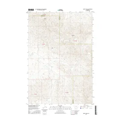
2017 Map of Sarpy School
USGS Topo · Published 2017About this map
Sarpy School serves as a central landmark in this 2017 survey of the Big Horn and Rosebud County borderlands. The landscape is defined by the high elevations of the Little Wolf Mountains and distinctive geographic points like Red Butte and Harris Canyon. This area of eastern Montana retains a pastoral, ranch-based character where life follows the drainage patterns of the E Fork Sarpy Cr, Black Hawk Cr, and E Fork Armells Cr. Transportation is focused on the singular corridor of Sarpy Rd, which navigates the complex terrain of the northern Tongue River basin. The map illustrates the continuing importance of these isolated rural school sites and water sources in a sparsely populated region of the state.
Find a feature on this map
16 named features on this map. Tap any name to fly to it.
Don’t see what you’re looking for? This feature index may not catch every label — zoom into the map to look around manually.
Map Details
Editions of this 2017 Sarpy School Map
This is the sole edition of this map. No revisions or reprints were ever made.
Other maps of this area

1954 · Hardin
USGS Topo · 1:250,000

1957 · Hardin
USGS Topo · 1:250,000

1958 · Hardin
USGS Topo · 1:250,000

1958 · Chalky Point
USGS Topo · 1:24,000

1958 · Black Spring
USGS Topo · 1:24,000

1967 · Jeans Fork NE
USGS Topo · 1:24,000

1971 · Trail Creek School
USGS Topo · 1:24,000

1971 · Mc Clure Creek
USGS Topo · 1:24,000

1971 · Rough Draw
USGS Topo · 1:24,000
1971 · Sarpy School
USGS Topo · 1:24,000