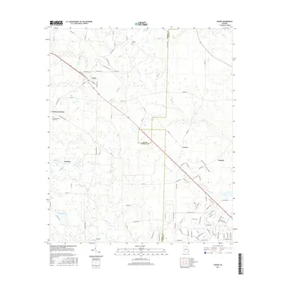
2017 Map of Sasser
USGS Topo · Published 2017About this map
The town of Sasser serves as the focal point of this rural Terrell County landscape, where the local road network radiates from a central grid including Railroad St and Main St W. The terrain is defined by the winding paths of several waterways, such as Fowltown Cr and Rock Hole Cr, which intersect the agricultural fields and timberlands. Small, historically significant settlements like Armena, Klondike, and Chickasawhatchee are scattered across the quadrangle, connected by routes like the Florida Short Rte. Genealogists will find several burial grounds noted, including the Chickasawhatchee Baptist Cem and Kiokee Cem near the southern border. The transition between Terrell and Lee counties is clearly marked, illustrating how these administrative boundaries bisect the natural drainage of Kiokee Cr and the vicinity of Albany Lake.
Find a feature on this map
101 named features on this map. Tap any name to fly to it.
Don’t see what you’re looking for? This feature index may not catch every label — zoom into the map to look around manually.
Map Details
Editions of this 2017 Sasser Map
This is the sole edition of this map. No revisions or reprints were ever made.
Other maps of this area

1953 · Dothan
USGS Topo · 1:250,000

1954 · Dothan
USGS Topo · 1:250,000

1955 · Dothan
USGS Topo · 1:250,000

1956 · Albany West
USGS Topo · 1:24,000

1956 · Sasser
USGS Topo · 1:62,500

1956 · Albany
USGS Topo · 1:62,500

1956 · Leslie
USGS Topo · 1:62,500

1973 · Chickasawhatchee
USGS Topo · 1:24,000

1973 · Sasser
USGS Topo · 1:24,000

1973 · Pretoria
USGS Topo · 1:24,000