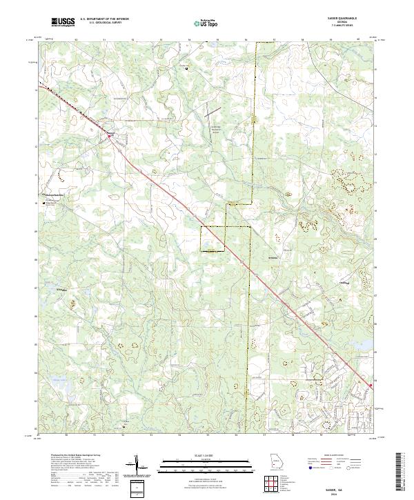
2024 Map of Sasser
USGS Topo · Published 2024About this map
Sasser sits at the heart of this southwest Georgia landscape, positioned where local roads and rail lines once dictated the flow of trade. The settlement pattern reveals the rural character of Terrell and Lee Counties, with small hubs like Armena and Oakland serving as persistent landmarks in a region defined by its agricultural heritage. Waterways such as Reedy Creek and Fowltown Creek meander through the terrain, while the presence of Grand Oak Plantation Airport indicates the modern evolution of these large landholdings. For those researching family history, several burial sites are documented across the quadrangle, including Chickasawhatchee Cem, Kiokee Cem, and Huckby Cem. The small community of Chickasawhatchee is anchored by the Village Baptist Church, illustrating the deep-rooted local importance of rural congregations and quiet crossroads like Klondike.
Find a feature on this map
102 named features on this map. Tap any name to fly to it.
Don’t see what you’re looking for? This feature index may not catch every label — zoom into the map to look around manually.
Map Details
Editions of this 2024 Sasser Map
This is the sole edition of this map. No revisions or reprints were ever made.
Other maps of this area

1953 · Dothan
USGS Topo · 1:250,000

1954 · Dothan
USGS Topo · 1:250,000

1955 · Dothan
USGS Topo · 1:250,000

1956 · Albany West
USGS Topo · 1:24,000

1956 · Sasser
USGS Topo · 1:62,500

1956 · Albany
USGS Topo · 1:62,500

1956 · Leslie
USGS Topo · 1:62,500

1973 · Chickasawhatchee
USGS Topo · 1:24,000

1973 · Sasser
USGS Topo · 1:24,000

1973 · Pretoria
USGS Topo · 1:24,000