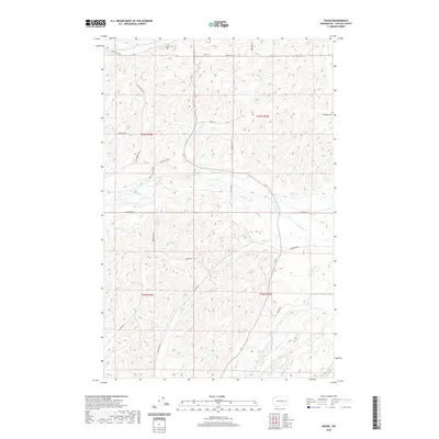
2020 Map of Sassin
USGS Topo · Published 2020About this map
Edwall Cem and Stockdale Cem sit at the northern and eastern edges of this rural landscape in Lincoln County. The terrain is defined by the drainage patterns of Hampton Cr and Rock Cr, which converge near Reiha Pond in the center of the sheet. This area illustrates the transition from high plateau farming to the creek-carved topography common in eastern Washington, with a dense network of sectional roads like Bluestem Rd E, Wollweber Rd N, and Waukon Rd N providing access to the various townships. Evidence of local transport history is found at Sassin Station Rd N, while numerous named roads such as Ringwood Rd and Franseen Rd reveal the influence of early family holdings on the region's development.
Find a feature on this map
26 named features on this map. Tap any name to fly to it.
Don’t see what you’re looking for? This feature index may not catch every label — zoom into the map to look around manually.
Map Details
Editions of this 2020 Sassin Map
This is the sole edition of this map. No revisions or reprints were ever made.
Other maps of this area

1945 · Reardan
USGS Topo · 1:62,500

1953 · Reardan
USGS Topo · 1:62,500

1953 · Ritzville
USGS Topo · 1:250,000

1954 · Sprague
USGS Topo · 1:62,500

1955 · Spokane
USGS Topo · 1:250,000

1958 · Spokane
USGS Topo · 1:250,000

1959 · Ritzville
USGS Topo · 1:250,000

1965 · Ritzville
USGS Topo · 1:250,000

1969 · Sprague Lake
USGS Topo · 1:24,000

1969 · Omans
USGS Topo · 1:24,000