
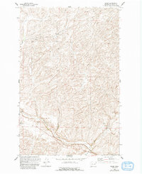
1969 Map of Omans
USGS Topo · Published 1972About this map
Omans and Bluestem anchor this agricultural landscape in Lincoln County, showing the region at the end of the 1960s. The terrain is defined by the winding course of Bluestem Creek and a network of grain storage infrastructure, including multiple Grain Elevators and Storage Bins situated along the rail corridor. These features point to a specialized wheat-farming economy that relied heavily on the transit power of the Burlington Northern railroad, which cuts through the undulating topography. Industrial activity is further evidenced by several Gravel Pits and a prominent Pipeline traversing the southern sections. This survey provides a clear view of the rural infrastructure that sustained these small Washington communities, from the essential rail sidings to the isolated pits used for local road maintenance and construction.
Find a feature on this map
9 named features on this map. Tap any name to fly to it.
Don’t see what you’re looking for? This feature index may not catch every label — zoom into the map to look around manually.
Map Details
Editions of this 1969 Omans Map
2 editions found
Other maps of this area

1945 · Reardan
USGS Topo · 1:62,500

1953 · Reardan
USGS Topo · 1:62,500

1953 · Ritzville
USGS Topo · 1:250,000

1954 · Sprague
USGS Topo · 1:62,500

1955 · Spokane
USGS Topo · 1:250,000

1958 · Spokane
USGS Topo · 1:250,000

1959 · Ritzville
USGS Topo · 1:250,000

1965 · Ritzville
USGS Topo · 1:250,000

1969 · Bluestem
USGS Topo · 1:24,000

1969 · Lords Valley
USGS Topo · 1:24,000