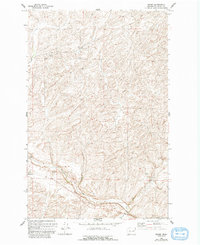
1969 Map of Omans
USGS Topo · Published 1993About this map
Omans serves as a focal point for the agricultural landscape of this eastern Washington region, defined by the winding course of Crab Creek and its tributary, Bluestem Creek. The map documents a rural economy tied closely to the land and its resources, evident in the prominent Grain Elevators and Storage Bins that anchor the small settlement. These structures, alongside several Gravel Pits scattered near the creek beds, reflect the primary industrial activities of the late 1960s.
Find a feature on this map
9 named features on this map. Tap any name to fly to it.
Don’t see what you’re looking for? This feature index may not catch every label — zoom into the map to look around manually.
Map Details
Editions of this 1969 Omans Map
2 editions found

Other maps of this area

1945 · Reardan
USGS Topo · 1:62,500

1953 · Reardan
USGS Topo · 1:62,500

1953 · Ritzville
USGS Topo · 1:250,000

1954 · Sprague
USGS Topo · 1:62,500

1955 · Spokane
USGS Topo · 1:250,000

1958 · Spokane
USGS Topo · 1:250,000

1959 · Ritzville
USGS Topo · 1:250,000

1965 · Ritzville
USGS Topo · 1:250,000

1969 · Bluestem
USGS Topo · 1:24,000

1969 · Lords Valley
USGS Topo · 1:24,000