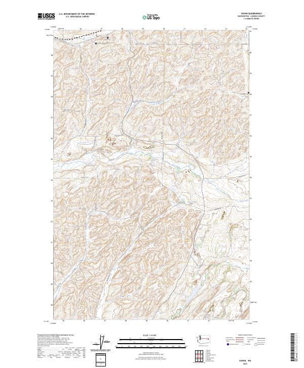
2023 Map of Sassin
USGS Topo · Published 2023About this map
Rock Creek winds through the central plateau of Lincoln County, defining the drainage patterns of a landscape marked by basalt coulees and agricultural road networks. The topographic detail reveals a region shaped by ice-age floods, where Hampton Creek and smaller drainages like those near Reiha Pond cut through the scablands. For genealogists, the map is particularly valuable for its documentation of three distinct burial grounds: the Edwall Cem and Edwall Catholic Cem in the north, and the Stockdale Cem to the east. These sites, along with names like Sassin Station Rd N, point to the early pioneer settlements and rail-stop history of this portion of the Inland Empire. The section lines of T23N and T22N organize a grid of family-named routes, including Wollweber Rd N and Merkel Rd N, which connect isolated farmsteads across the rolling terrain.
Find a feature on this map
28 named features on this map. Tap any name to fly to it.
Don’t see what you’re looking for? This feature index may not catch every label — zoom into the map to look around manually.
Map Details
Editions of this 2023 Sassin Map
This is the sole edition of this map. No revisions or reprints were ever made.
Other maps of this area

1945 · Reardan
USGS Topo · 1:62,500

1953 · Reardan
USGS Topo · 1:62,500

1953 · Ritzville
USGS Topo · 1:250,000

1954 · Sprague
USGS Topo · 1:62,500

1955 · Spokane
USGS Topo · 1:250,000

1958 · Spokane
USGS Topo · 1:250,000

1959 · Ritzville
USGS Topo · 1:250,000

1965 · Ritzville
USGS Topo · 1:250,000

1969 · Sprague Lake
USGS Topo · 1:24,000

1969 · Omans
USGS Topo · 1:24,000