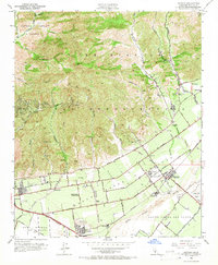
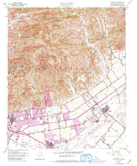
1951 Map of Saticoy
USGS Topo · Published 1966About this map
The Santa Clara River valley and its surrounding foothills are depicted here as a landscape of intensive agriculture and early petroleum development in the mid-century. Large Mexican land grants like Ex-Mission San Buenaventura and San Miguel (Olivas and Lorenzana) provide the underlying structure for the region's growth. In the northern hills, extensive oil wells, sumps, and tanks dot the drainages of Hall Canyon and Sexton Canyon, illustrating the era's energy extraction.
Find a feature on this map
61 named features on this map. Tap any name to fly to it.
Don’t see what you’re looking for? This feature index may not catch every label — zoom into the map to look around manually.
Map Details
Editions of this 1951 Saticoy Map
5 editions found
Other maps of this area

1903 · Santa Paula
USGS Topo · 1:62,500

1904 · Ventura
USGS Topo · 1:62,500

1904 · Hueneme
USGS Topo · 1:62,500

1941 · Ventura
USGS Topo · 1:62,500

1942 · Santa Paula
USGS Topo · 1:62,500

1942 · Hueneme
USGS Topo · 1:62,500

1943 · Hueneme
USGS Topo · 1:62,500

1947 · Santa Paula
USGS Topo · 1:62,500

1949 · Los Angeles
USGS Topo · 1:250,000

1949 · Oxnard
USGS Topo · 1:24,000