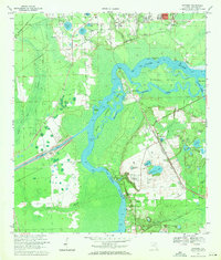
1968 Map of Satsuma
USGS Topo · Published 1971About this map
The St Johns River dominates this landscape of Putnam County, winding through an intricate network of wetlands and islands including Murphy Island and the Seven Sisters Islands. In the late 1960s, the river served as a primary artery for local life, with small riverside settlements like Buffalo Bluff and Nashua positioned along its banks. The presence of the Florida Barge Canal cutting through the western marshes reflects the era's major infrastructure ambitions for internal waterways. Away from the main channel, the terrain is dotted with small lakes such as Saratoga Lake and Castle Lake, while the Seaboard Coast Line railroad runs parallel to the river, connecting the community of Satsuma to the broader regional economy. Local history is anchored by several rural landmarks, including Trinity Church and Satsuma Cemetery, illustrating the established social fabric of these small Florida river towns.
Find a feature on this map
54 named features on this map. Tap any name to fly to it.
Don’t see what you’re looking for? This feature index may not catch every label — zoom into the map to look around manually.
Map Details
Editions of this 1968 Satsuma Map
4 editions found
Other maps of this area

1912 · Palatka
USGS Topo · 1:48,000

1915 · Palatka
USGS Topo · 1:62,500

1915 · Interlachen
USGS Topo · 1:48,000

1916 · Interlachen
USGS Topo · 1:62,500

1944 · Interlachen
USGS Topo · 1:62,500

1949 · Baywood
USGS Topo · 1:24,000

1949 · Rodman
USGS Topo · 1:24,000

1949 · Interlachen
USGS Topo · 1:62,500

1954 · Daytona Beach
USGS Topo · 1:250,000

1958 · Daytona Beach
USGS Topo · 1:250,000