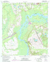
1968 Map of Satsuma
USGS Topo · Published 1986About this map
The St Johns River defines this portion of Putnam County, winding past riverside settlements and timbered lowlands during the late twentieth century. Along the eastern bank, the communities of Satsuma, Nashua, and Sisco are situated near the Seaboard Coast Line railroad, which parallels the river's course. This period shows the active footprint of the Cross Florida Barge Canal, including the St Johns Lock located where the canal intersects the river.
Find a feature on this map
55 named features on this map. Tap any name to fly to it.
Don’t see what you’re looking for? This feature index may not catch every label — zoom into the map to look around manually.
Map Details
Editions of this 1968 Satsuma Map
4 editions found
Other maps of this area

1912 · Palatka
USGS Topo · 1:48,000

1915 · Palatka
USGS Topo · 1:62,500

1915 · Interlachen
USGS Topo · 1:48,000

1916 · Interlachen
USGS Topo · 1:62,500

1944 · Interlachen
USGS Topo · 1:62,500

1949 · Baywood
USGS Topo · 1:24,000

1949 · Rodman
USGS Topo · 1:24,000

1949 · Interlachen
USGS Topo · 1:62,500

1954 · Daytona Beach
USGS Topo · 1:250,000

1958 · Daytona Beach
USGS Topo · 1:250,000