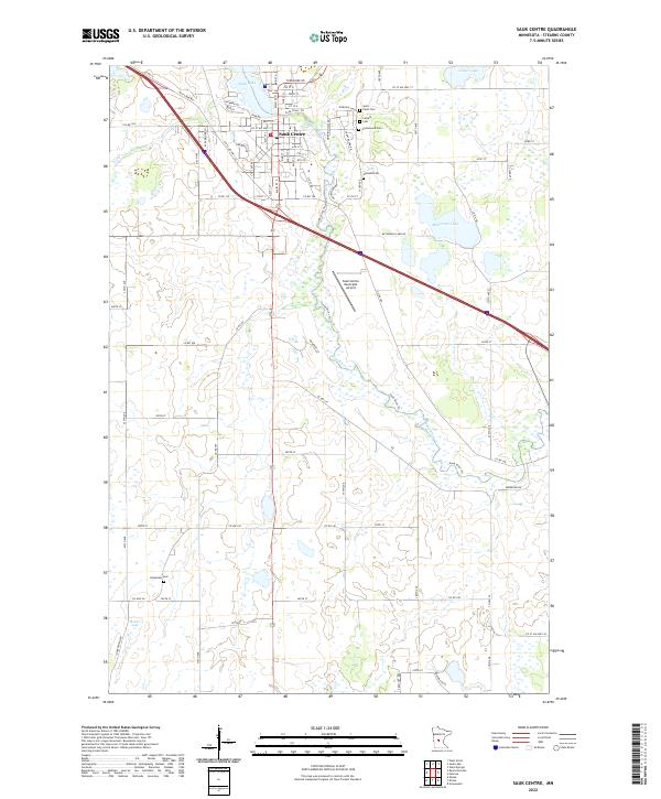
2022 Map of Sauk Centre
USGS Topo · Published 2022About this map
Sauk Centre is the primary focus of this Stearns County study, situated where the Sauk River flows out of Sauk Lake. The landscape is a network of water and memory, with the town core surrounded by several burial grounds including Saint Pauls Cem, Calvary Cem, Greenwood Cem, and Oakland Cem. The township divisions of t126n r34w and t125n r34w reveal a rural infrastructure defined by numerous county roads like Co RD 186 and the modern presence of the Sauk Centre Municipal Airport. To the south, the terrain becomes increasingly dotted with wetlands and small basins such as Moliter Lake, while the Sauk River Trl follows the water's path toward the southeast corner. The distribution of family-connected sites like Bohemian Cem and the various residential drives suggests a settled agricultural community that maintains its historical ties even in the 21st century.
Find a feature on this map
58 named features on this map. Tap any name to fly to it.
Don’t see what you’re looking for? This feature index may not catch every label — zoom into the map to look around manually.
Map Details
Editions of this 2022 Sauk Centre Map
This is the sole edition of this map. No revisions or reprints were ever made.
Other maps of this area

1953 · Saint Cloud
USGS Topo · 1:250,000

1957 · Saint Cloud
USGS Topo · 1:250,000

1958 · Saint Cloud
USGS Topo · 1:250,000

1965 · Greenwald
USGS Topo · 1:24,000

1965 · Sauk Centre
USGS Topo · 1:24,000

1965 · Melrose
USGS Topo · 1:24,000

1965 · Padua
USGS Topo · 1:24,000

1965 · Raymond Lake
USGS Topo · 1:24,000

1965 · Elrosa
USGS Topo · 1:24,000

1966 · West Union
USGS Topo · 1:24,000