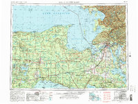
1954 Map of Sault Sainte Marie
USGS Topo · Published 1982About this map
Sault Sainte Marie serves as the international focal point of this Eastern Upper Peninsula survey, where the Saint Marys River connects the vast waters of Lake Superior and Lake Huron. The landscape is defined by the heavy presence of public lands, including the expansive Lake Superior State Forest and the Hiawatha National Forest. Small lumbering and railroad towns like Seney, Newberry, and Trout Lake dot the corridors of the Soo Line, reflecting the region's industrial reliance on timber and rail transport.
Find a feature on this map
133 named features on this map. Tap any name to fly to it.
Don’t see what you’re looking for? This feature index may not catch every label — zoom into the map to look around manually.
Map Details
Editions of this 1954 Sault Sainte Marie Map
3 editions found

Other maps of this area

1913 · Sault Sainte Marie
USGS Topo · 1:62,500

1919 · Neebish
USGS Topo · 1:62,500

1931 · St Ignace NW
USGS Topo · 1:31,680

1931 · Seney SW
USGS Topo · 1:31,680

1931 · Seney NW
USGS Topo · 1:31,680

1931 · Pickford SE
USGS Topo · 1:31,680

1931 · Epoufette SE
USGS Topo · 1:31,680

1931 · Manistique River NE
USGS Topo · 1:31,680

1931 · Driggs Lake NE
USGS Topo · 1:31,680

1931 · Gould City NE
USGS Topo · 1:31,680