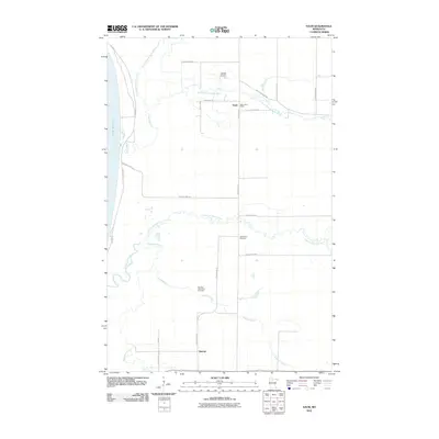
2010 Map of Saum
USGS Topo · Published 2010About this map
Lower Red Lake anchors the western edge of this northern Minnesota landscape, where the North Branch Battle River and South Branch Battle River converge near the small community of Saum. The area is defined by its complex hydrology, with the Blackduck River and North Cormorant River winding through the terrain toward the lake. This 2010 survey illustrates a rural settlement pattern focused on small junctions and agriculture, connected by local routes like Pioneer Rd NE and County Hwy 104.
Find a feature on this map
27 named features on this map. Tap any name to fly to it.
Don’t see what you’re looking for? This feature index may not catch every label — zoom into the map to look around manually.
Map Details
Editions of this 2010 Saum Map
This is the sole edition of this map. No revisions or reprints were ever made.
Other maps of this area

1919 · Fox
USGS Topo · 1:62,500

1919 · Quiring
USGS Topo · 1:62,500

1919 · Ponemah
USGS Topo · 1:62,500

1943 · Ponemah
USGS Topo · 1:62,500

1954 · Bemidji
USGS Topo · 1:250,000

1954 · Roseau
USGS Topo · 1:250,000

1957 · Roseau
USGS Topo · 1:250,000

1957 · Bemidji
USGS Topo · 1:250,000

1958 · Bemidji
USGS Topo · 1:250,000

1958 · Roseau
USGS Topo · 1:250,000