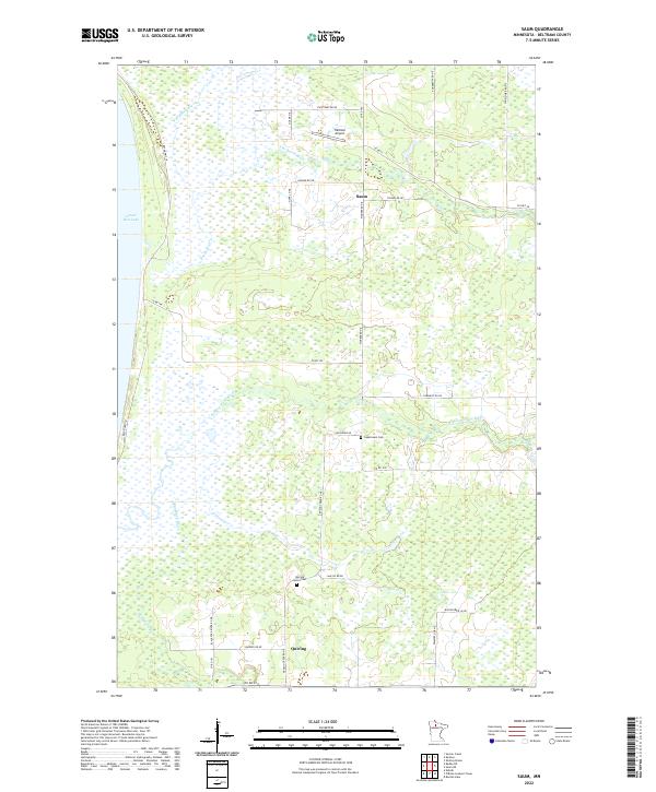
2022 Map of Saum
USGS Topo · Published 2022About this map
Lower Red Lake anchors the western edge of this Beltrami County landscape, where a dense network of watercourses drains toward the basin. The settlement of Saum serves as a local hub, situated amidst a low-lying terrain defined by the winding paths of the Battle River, N Cormorant River, and Blackduck River. These rivers create a complex hydraulic pattern that has historically shaped the timber and agricultural potential of the region.
Find a feature on this map
39 named features on this map. Tap any name to fly to it.
Don’t see what you’re looking for? This feature index may not catch every label — zoom into the map to look around manually.
Map Details
Editions of this 2022 Saum Map
This is the sole edition of this map. No revisions or reprints were ever made.
Other maps of this area

1919 · Fox
USGS Topo · 1:62,500

1919 · Quiring
USGS Topo · 1:62,500

1919 · Ponemah
USGS Topo · 1:62,500

1943 · Ponemah
USGS Topo · 1:62,500

1954 · Bemidji
USGS Topo · 1:250,000

1954 · Roseau
USGS Topo · 1:250,000

1957 · Roseau
USGS Topo · 1:250,000

1957 · Bemidji
USGS Topo · 1:250,000

1958 · Bemidji
USGS Topo · 1:250,000

1958 · Roseau
USGS Topo · 1:250,000