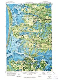
1972 Map of Saum
USGS Topo · Published 1974About this map
Lower Red Lake dominates the western edge of this orthophotomap, where the Red Lake Indian Reservation Boundary meets the townships of Battle and Quiring. The landscape is a complex network of wetlands and meandering waterways, defined by the North Branch Battle River and South Branch Battle River flowing toward the lake. This 1970s survey captures the area's rural character through small community hubs like Saum and Quiring, and local landmarks such as Cem Folden Ch. The integration of aerial photography with topographic data provides an unusually clear view of the shifting drainage patterns across Cormant and Woodrow. Researchers will find significant genealogical and historical markers, including the Cormorant Ch and the Old Indian Trail, which reflects the long-standing human geography of this Beltrami County terrain.
Find a feature on this map
19 named features on this map. Tap any name to fly to it.
Don’t see what you’re looking for? This feature index may not catch every label — zoom into the map to look around manually.
Map Details
Editions of this 1972 Saum Map
This is the sole edition of this map. No revisions or reprints were ever made.
Other maps of this area

1919 · Fox
USGS Topo · 1:62,500

1919 · Quiring
USGS Topo · 1:62,500

1919 · Ponemah
USGS Topo · 1:62,500

1943 · Ponemah
USGS Topo · 1:62,500

1954 · Bemidji
USGS Topo · 1:250,000

1954 · Roseau
USGS Topo · 1:250,000

1957 · Roseau
USGS Topo · 1:250,000

1957 · Bemidji
USGS Topo · 1:250,000

1958 · Bemidji
USGS Topo · 1:250,000

1958 · Roseau
USGS Topo · 1:250,000