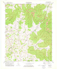
1978 Map of Savage
USGS Topo · Published 1979About this map
The rugged boundary between Clinton and Wayne counties defines this 1970s landscape, where the agricultural flats of Duvall Valley meet the heavily mined slopes of Poplar Mountain. The town of Albany anchors the western edge, while a network of smaller rural communities like Upchurch, Cartwright, and Savage are connected by winding creeks and ridge roads. Local life is documented through numerous country churches, including Smith Chapel and Central Grove Church, alongside family burial grounds such as Craig Cemetery and Savage Cemetery.
Find a feature on this map
52 named features on this map. Tap any name to fly to it.
Don’t see what you’re looking for? This feature index may not catch every label — zoom into the map to look around manually.
Map Details
Editions of this 1978 Savage Map
2 editions found
Other maps of this area

1911 · Monticello
USGS Topo · 1:62,500

1914 · Monticello
USGS Topo · 1:62,500

1929 · Byrdstown
USGS Topo · 1:62,500

1934 · Pall Mall
USGS Topo · 1:62,500

1953 · Parnell
USGS Topo · 1:24,000

1953 · Wolf Creek Dam
USGS Topo · 1:24,000

1954 · Cumberland City
USGS Topo · 1:24,000

1954 · Albany
USGS Topo · 1:24,000

1954 · Savage
USGS Topo · 1:24,000

1954 · Powersburg
USGS Topo · 1:24,000