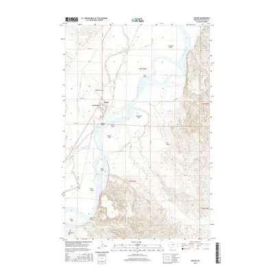
2017 Map of Savage
USGS Topo · Published 2017About this map
The Yellowstone River dominates this landscape in Richland County, Montana, where its braided channels and seasonal fluctuations have sculpted a series of named landforms such as Crittenden Island, Elk Island, and Breakneck Island. The settlement of Savage serves as the local hub, situated where the high plains meet the river valley. The agricultural heritage of the region is evident in the extensive irrigation infrastructure, most notably the Main Canal which runs parallel to the river. Near the town site, researchers can locate Riverview Cem and the neighboring community of Knife River. To the south, the terrain shifts from fertile river bottoms to more complex relief, marked by features like Devils Canyon and the broad Valentine Flat. This record documents the intricate balance between the river's natural course and the human efforts to manage its waters for the surrounding ranching and farming lands.
Find a feature on this map
40 named features on this map. Tap any name to fly to it.
Don’t see what you’re looking for? This feature index may not catch every label — zoom into the map to look around manually.
Map Details
Editions of this 2017 Savage Map
This is the sole edition of this map. No revisions or reprints were ever made.
Other maps of this area

1909 · Glendive
USGS Topo · 1:250,000

1954 · Glendive
USGS Topo · 1:250,000

1957 · Glendive
USGS Topo · 1:250,000

1958 · Glendive
USGS Topo · 1:250,000

1966 · Savage
USGS Topo · 1:24,000

1966 · Savage SE
USGS Topo · 1:24,000

1966 · Savage SW
USGS Topo · 1:24,000

1966 · Piche
USGS Topo · 1:24,000

1966 · Knife River Mine
USGS Topo · 1:24,000

1966 · Crane
USGS Topo · 1:24,000