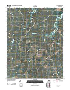
2011 Map of Savedge
USGS Topo · Published 2011About this map
Burrowsville and the surrounding Prince George County countryside are defined by a network of creeks and small ponds that feed into the James River watershed. The terrain is crisscrossed by established rural routes such as Brandon Rd and Lebanon Rd, which connect small agrarian settlements and crossroads like Oak Hill Corner and Cabin Point. This landscape preserves several historical markers of community life, notably the Brandon Cemetery and Salem Cemetery located near the intersection of Morning Star Rd.
Find a feature on this map
45 named features on this map. Tap any name to fly to it.
Don’t see what you’re looking for? This feature index may not catch every label — zoom into the map to look around manually.
Map Details
Editions of this 2011 Savedge Map
This is the sole edition of this map. No revisions or reprints were ever made.
Other maps of this area

1917 · Toano
USGS Topo · 1:62,500

1918 · Charles City
USGS Topo · 1:62,500

1918 · Toano
USGS Topo · 1:62,500

1919 · Surry
USGS Topo · 1:62,500

1919 · Disputanta
USGS Topo · 1:62,500

1943 · Savedge
USGS Topo · 1:31,680

1943 · Disputanta
USGS Topo · 1:31,680

1943 · Richmond
USGS Topo · 1:250,000

1944 · Waverly
USGS Topo · 1:31,680
1944 · Nebletts Mill
USGS Topo · 1:31,680