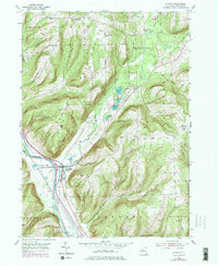
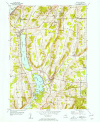
1953 Map of Savona
USGS Topo · Published 1978About this map
The Cohocton River valley serves as the primary corridor for commerce and transit through this part of Steuben County, where the village of Savona is positioned at the confluence with Mud Creek. The landscape transitions from the river bottom to several prominent heights, including Irish Hill, Oak Hill, and Platt Hill. Large tracts of Reforestation Area suggest a shifting 20th-century land-use pattern away from traditional hillside farming toward managed timber and conservation.
Find a feature on this map
34 named features on this map. Tap any name to fly to it.
Don’t see what you’re looking for? This feature index may not catch every label — zoom into the map to look around manually.
Map Details
Editions of this 1953 Savona Map
4 editions found
Other maps of this area

1903 · Hammondsport
USGS Topo · 1:62,500

1910 · Bath
USGS Topo · 1:62,500

1914 · Corning
USGS Topo · 1:62,500

1924 · Woodhull
USGS Topo · 1:48,000

1926 · Woodhull
USGS Topo · 1:62,500

1944 · Woodhull
USGS Topo · 1:62,500

1944 · Corning
USGS Topo · 1:62,500

1950 · Elmira
USGS Topo · 1:250,000
1953 · Wayne
USGS Topo · 1:24,000

1953 · Campbell
USGS Topo · 1:24,000