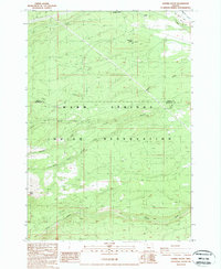
1988 Map of Sawmill Butte
USGS Topo · Published 1988About this map
The Warm Springs Indian Reservation dominates the southern landscape of this 1980s quadrangle, where the terrain is defined by a complex drainage system flowing from the high ground of Sawmill Butte and North Butte. The map documents a rugged timber and watershed environment in central Oregon, marked by the historical footprint of the lumber industry at Old Mill Camp and a primary Mill located along the northern reaches of Mill Creek.
Find a feature on this map
14 named features on this map. Tap any name to fly to it.
Don’t see what you’re looking for? This feature index may not catch every label — zoom into the map to look around manually.
Map Details
Editions of this 1988 Sawmill Butte Map
2 editions found
Other maps of this area

1927 · Mt. Jefferson
USGS Topo · 1:125,000

1928 · Madras
USGS Topo · 1:125,000

1930 · Mt. Jefferson
USGS Topo · 1:125,000

1931 · Madras
USGS Topo · 1:125,000

1955 · Bend
USGS Topo · 1:250,000

1957 · Bend
USGS Topo · 1:250,000

1958 · Bend
USGS Topo · 1:250,000

1961 · Whitewater River
USGS Topo · 1:62,500

1961 · Fort Butte
USGS Topo · 1:62,500

1962 · Metolius Bench
USGS Topo · 1:24,000