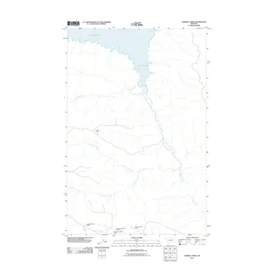
2011 Map of Sawmill Creek
USGS Topo · Published 2011About this map
Fort Peck Lake dominates the northern reaches of this Garfield County landscape, where the Missouri River's impoundment creates a complex shoreline of branching coulees and deep inlets. The interior terrain is defined by an intricate drainage system, including Sawmill Creek and its branches, North Sawmill Creek and South Sawmill Creek, alongside Big Coulee Creek. This 2011 survey reveals a landscape largely shaped by ranching and small-scale water management, evidenced by the presence of Wilson Ranch. Local land use is further characterized by numerous small earthen structures, such as Harold Number 3 Dam, Loomis D Number 1 Dam, and Chuch Number 1 Dam. These features illustrate the essential nature of water catchment for agricultural sustainability in this portion of the Montana plains.
Find a feature on this map
11 named features on this map. Tap any name to fly to it.
Don’t see what you’re looking for? This feature index may not catch every label — zoom into the map to look around manually.
Map Details
Editions of this 2011 Sawmill Creek Map
This is the sole edition of this map. No revisions or reprints were ever made.
Other maps of this area

1954 · Jordan
USGS Topo · 1:250,000

1956 · Jordan
USGS Topo · 1:250,000

1958 · Jordan
USGS Topo · 1:250,000

1964 · Jordan
USGS Topo · 1:250,000

1965 · Spring Creek School
USGS Topo · 1:24,000

1965 · Pine Grove School
USGS Topo · 1:24,000

1965 · Schuyler Butte
USGS Topo · 1:24,000

1971 · Wolfe Coulee
USGS Topo · 1:24,000

1971 · Sawmill Creek
USGS Topo · 1:24,000

1971 · Chalk Butte
USGS Topo · 1:24,000