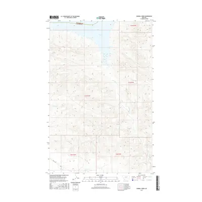
2017 Map of Sawmill Creek
USGS Topo · Published 2017About this map
Fort Peck Lake dominates the northern reaches of this landscape, where the waters of the Missouri River are impounded along the border of Phillips and Garfield counties. This 2017 survey illustrates a rugged drainage system where the primary waterway of Sawmill Creek is fed by numerous tributaries including N Sawmill Cr and S Sawmill Cr. The terrain is defined by complex coulees and ridges typical of the Missouri Breaks region, with Big Coulee Cr and Seven Blackfoot Cr carving deep paths toward the lake. Human presence is sparse in this section of Montana, with Brusett Rd providing the principal overland access through the southern reaches of the quadrangle. The map is a vital record for understanding the modern shoreline and the intricate network of seasonal creeks that shape this remote ranching and recreation territory.
Find a feature on this map
14 named features on this map. Tap any name to fly to it.
Don’t see what you’re looking for? This feature index may not catch every label — zoom into the map to look around manually.
Map Details
Editions of this 2017 Sawmill Creek Map
This is the sole edition of this map. No revisions or reprints were ever made.
Other maps of this area

1954 · Jordan
USGS Topo · 1:250,000

1956 · Jordan
USGS Topo · 1:250,000

1958 · Jordan
USGS Topo · 1:250,000

1964 · Jordan
USGS Topo · 1:250,000

1965 · Spring Creek School
USGS Topo · 1:24,000

1965 · Pine Grove School
USGS Topo · 1:24,000

1965 · Schuyler Butte
USGS Topo · 1:24,000

1971 · Wolfe Coulee
USGS Topo · 1:24,000

1971 · Sawmill Creek
USGS Topo · 1:24,000

1971 · Chalk Butte
USGS Topo · 1:24,000