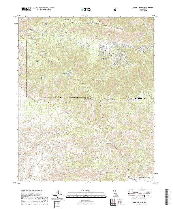
2022 Map of Sawmill Mountain
USGS Topo · Published 2022About this map
Pine Mountain Club serves as the primary residential hub within this high-elevation landscape of the Los Padres National Forest. The map details a complex network of alpine roads, such as Bernina Dr and St Anton Dr, which weave through the community near the base of Sawmill Mtn. This modern survey reveals a rugged geography defined by sharp transitions between peaks like Mt Pinos and the deep incisions of Apache Canyon and Dry Canyon. The boundary between Kern and Ventura counties bisects these heights, marking a divide between the southern edge of the San Joaquin Valley and the northern wilderness of the Transverse Ranges. Outdoor recreation and fire management infrastructure are prominent, evidenced by numerous technical tracks including the San Emigdio Ohv Trl and the North Fork Lockwood Trl which connects the high ridges to Lilly Meadows and Lockwood Valley.
Find a feature on this map
66 named features on this map. Tap any name to fly to it.
Don’t see what you’re looking for? This feature index may not catch every label — zoom into the map to look around manually.
Map Details
Editions of this 2022 Sawmill Mountain Map
This is the sole edition of this map. No revisions or reprints were ever made.
Other maps of this area

1903 · Mt. Pinos
USGS Topo · 1:125,000

1942 · Eagle Rest Peak
USGS Topo · 1:24,000

1943 · Apache Canyon
USGS Topo · 1:24,000

1943 · San Guillermo
USGS Topo · 1:24,000

1943 · Sawmill Mountain
USGS Topo · 1:24,000

1943 · Santiago Creek
USGS Topo · 1:24,000

1943 · Cuddy Valley
USGS Topo · 1:24,000

1943 · Lockwood Valley
USGS Topo · 1:24,000

1943 · Reyes Peak
USGS Topo · 1:24,000
1944 · San Guillermo
USGS Topo · 1:31,680