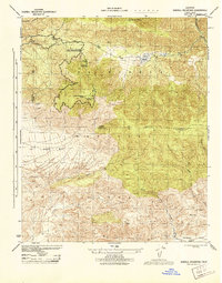
1944 Map of Sawmill Mountain
USGS Topo · Published 1944About this map
Los Padres National Forest covers these high-elevation ridges along the boundary of Ventura and Kern counties as they appeared in 1944. The landscape is defined by the massive peaks of Cerro Noroeste (Abel Mtn) and Sawmill Mtn, leading toward the prominent Mt Pinos Lookout. This wartime-era survey by the War Department Corps of Engineers shows the region's early recreational and administrative development through sites like Camp Condor, Cerro Noroeste Camp, and the Fourth Road District Maintenance Station.
Find a feature on this map
24 named features on this map. Tap any name to fly to it.
Don’t see what you’re looking for? This feature index may not catch every label — zoom into the map to look around manually.
Map Details
Editions of this 1944 Sawmill Mountain Map
This is the sole edition of this map. No revisions or reprints were ever made.
Other maps of this area

1903 · Mt. Pinos
USGS Topo · 1:125,000

1942 · Eagle Rest Peak
USGS Topo · 1:24,000

1943 · Apache Canyon
USGS Topo · 1:24,000

1943 · San Guillermo
USGS Topo · 1:24,000

1943 · Sawmill Mountain
USGS Topo · 1:24,000

1943 · Santiago Creek
USGS Topo · 1:24,000

1943 · Cuddy Valley
USGS Topo · 1:24,000

1943 · Lockwood Valley
USGS Topo · 1:24,000

1943 · Reyes Peak
USGS Topo · 1:24,000
1944 · San Guillermo
USGS Topo · 1:31,680