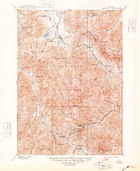
1900 Map of Sawtooth
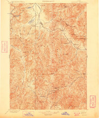
USGS Topo · Published 1948About this map
The Sawtooth Mountains and surrounding ranges dominate this late nineteenth-century landscape, a region defined by high-altitude mining operations and the headwaters of major Idaho rivers. Settled at the intersections of steep gulches and creek beds, small outposts like Vienna and Galena serve as hubs for silver and gold extraction. The map reveals a cluster of activity in the south, where the King of the West Mine, Stormy Galore Mine, and Silver Star Mine sit near the settlement of Carrietown.
Find a feature on this map
77 named features on this map. Tap any name to fly to it.
Don’t see what you’re looking for? This feature index may not catch every label — zoom into the map to look around manually.
Map Details
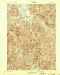
Editions of this 1900 Sawtooth Map
4 editions found
Other maps of this area

1891 · Bear Valley
USGS Topo · 1:125,000

1892 · Camas Prairie
USGS Topo · 1:125,000

1893 · Bear Valley
USGS Topo · 1:125,000

1893 · Camas Prairie
USGS Topo · 1:125,000

1894 · Rocky Bar
USGS Topo · 1:125,000

1895 · Hailey
USGS Topo · 1:125,000

1897 · Hailey
USGS Topo · 1:125,000

1900 · Sawtooth
USGS Topo · 1:125,000

1919 · Custer
USGS Topo · 1:125,000

1922 · Custer
USGS Topo · 1:125,000