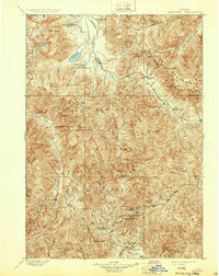
1900 Map of Sawtooth
USGS Topo · Published 1932About this map
Mining camps and glacial lakes dominate this high-elevation survey of central Idaho, reflecting the territory as it appeared during the late nineteenth-century silver boom. Settlements like Vienna and Sawtooth are situated near the headwaters of the Salmon River, serving as hubs for hard-rock operations such as the Silver King Mine and the Columbia Mill. To the south, the landscape shifts toward the drainage of the Big Wood River, where further extraction sites like the Snow Star Mine and King of the West Mine are clustered near Warm Spring Creek. The map documents early resource extraction including the Rollins Placer and Rives Placer along Big Smoky Creek. Amidst the high peaks of the Sawtooth Mountains, the survey identifies hydrothermal features like Worswick Hot Springs and the remote outpost of Russian John, providing a detailed view of the region's early industrial and thermal geography.
Find a feature on this map
59 named features on this map. Tap any name to fly to it.
Don’t see what you’re looking for? This feature index may not catch every label — zoom into the map to look around manually.
Map Details
Editions of this 1900 Sawtooth Map
4 editions found
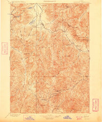
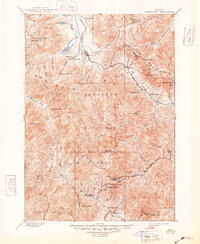
Other maps of this area

1891 · Bear Valley
USGS Topo · 1:125,000

1892 · Camas Prairie
USGS Topo · 1:125,000

1893 · Bear Valley
USGS Topo · 1:125,000

1893 · Camas Prairie
USGS Topo · 1:125,000

1894 · Rocky Bar
USGS Topo · 1:125,000

1895 · Hailey
USGS Topo · 1:125,000

1897 · Hailey
USGS Topo · 1:125,000

1900 · Sawtooth
USGS Topo · 1:125,000

1919 · Custer
USGS Topo · 1:125,000

1922 · Custer
USGS Topo · 1:125,000