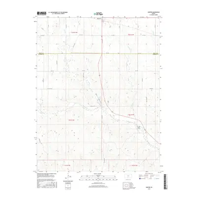
2016 Map of Sawyer
USGS Topo · Published 2016About this map
Sawyer sits at the northern edge of this Kansas landscape, positioned along the boundary where the prairie meets the drainage basins of several local waterways. The terrain is defined by the branching paths of N Elm Cr, Crooked Cr, and Amber Cr, which carve through the agricultural sections of the High Plains. This 2016 survey illustrates a traditional grid of section lines and rural roads such as Mingona Rd and Rainbow Rd, reflecting the enduring land management patterns of Pratt and Barber Counties. Further south, the map reveals the aviation footprint of the Elm Creek Farms Airport situated near the banks of Elm Creek. The distribution of these water bodies and transport routes highlights the area's transition between concentrated settlement and open ranching or farming land.
Find a feature on this map
37 named features on this map. Tap any name to fly to it.
Don’t see what you’re looking for? This feature index may not catch every label — zoom into the map to look around manually.
Map Details
Editions of this 2016 Sawyer Map
This is the sole edition of this map. No revisions or reprints were ever made.
Other maps of this area

1891 · Medicine Lodge
USGS Topo · 1:125,000

1892 · Pratt
USGS Topo · 1:125,000

1893 · Medicine Lodge
USGS Topo · 1:125,000

1894 · Pratt
USGS Topo · 1:125,000

1955 · Pratt
USGS Topo · 1:250,000

1959 · Pratt
USGS Topo · 1:250,000

1968 · Pratt SW
USGS Topo · 1:24,000

1968 · Coats
USGS Topo · 1:24,000
1968 · Pratt SE
USGS Topo · 1:24,000
1973 · Sun City NE
USGS Topo · 1:24,000