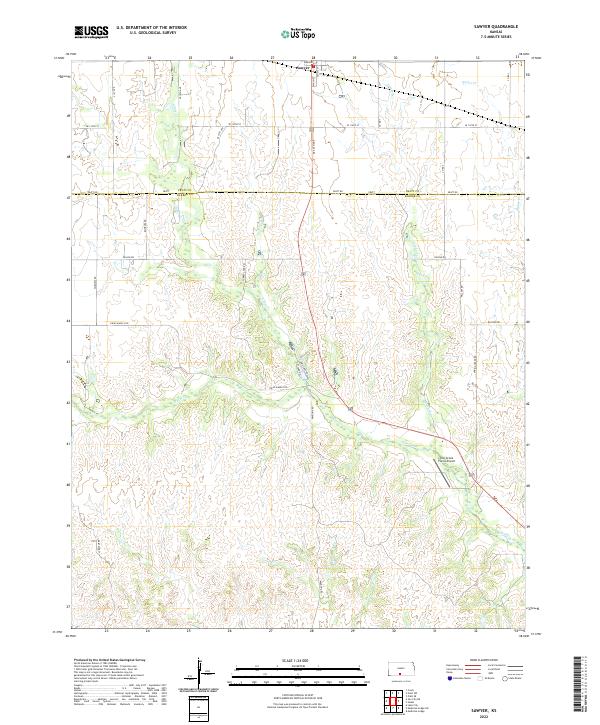
2022 Map of Sawyer
USGS Topo · Published 2022About this map
Sawyer stands at the northern edge of this landscape, positioned along the border where Pratt and Barber counties meet. The area is defined by the branching drainage of Elm Creek, which draws a complex network of coulees and draws across the terrain. This water system, including tributaries like N Elm Cr and Crooked Cr, dictates the placement of the local road network, which often skirts the edges of the deeper creek beds.
Find a feature on this map
36 named features on this map. Tap any name to fly to it.
Don’t see what you’re looking for? This feature index may not catch every label — zoom into the map to look around manually.
Map Details
Editions of this 2022 Sawyer Map
This is the sole edition of this map. No revisions or reprints were ever made.
Other maps of this area

1891 · Medicine Lodge
USGS Topo · 1:125,000

1892 · Pratt
USGS Topo · 1:125,000

1893 · Medicine Lodge
USGS Topo · 1:125,000

1894 · Pratt
USGS Topo · 1:125,000

1955 · Pratt
USGS Topo · 1:250,000

1959 · Pratt
USGS Topo · 1:250,000

1968 · Pratt SW
USGS Topo · 1:24,000

1968 · Coats
USGS Topo · 1:24,000
1968 · Pratt SE
USGS Topo · 1:24,000
1973 · Sun City NE
USGS Topo · 1:24,000