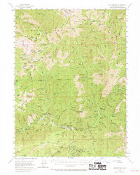
1955 Map of Sawyers Bar
USGS Topo · Published 1970About this map
Sawyers Bar serves as the central hub of this mid-century survey, situated along the North Fork Salmon River in the heart of the Klamath National Forest. The map documents a landscape defined by its mining heritage, particularly along the southern reaches near Bestville (Site) and the Sawyers Bar P O. Dozens of named mines, including the Uncle Sam Mine, Black Bear Mine, and Klamath Mine, are clustered around Blue Ridge and the South Fork Salmon River, indicating the intense geological interest that shaped this portion of Siskiyou County.
Find a feature on this map
174 named features on this map. Tap any name to fly to it.
Don’t see what you’re looking for? This feature index may not catch every label — zoom into the map to look around manually.
Map Details
Editions of this 1955 Sawyers Bar Map
3 editions found

Other maps of this area

1886 · Shasta
USGS Topo · 1:250,000

1894 · Shasta
USGS Topo · 1:250,000

1914 · Seiad
USGS Topo · 1:125,000

1922 · Seiad
USGS Topo · 1:125,000

1923 · Sawyers Bar
USGS Topo · 1:125,000

1931 · Etna
USGS Topo · 1:96,000

1932 · Yreka
USGS Topo · 1:96,000

1934 · Etna
USGS Topo · 1:125,000

1939 · Yreka
USGS Topo · 1:125,000

1948 · Weed
USGS Topo · 1:250,000