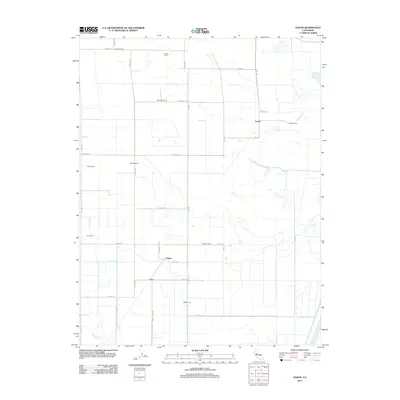
2012 Map of Saxon
USGS Topo · Published 2012About this map
Tremont Hall and the nearby Tremont Cem anchor the northern landscape of this agricultural region in Solano County, documented during the early 21st century. The map reveals a land defined by large-scale farming and ranching operations, with many properties identified by family or enterprise names such as Maxwell Ranch, Glide Ranch, and Dana Ranch. This pattern of land use is supported by an extensive grid of local roads and levees, including West Levee, which manage the water levels of the low-lying Central Valley terrain.
Find a feature on this map
41 named features on this map. Tap any name to fly to it.
Don’t see what you’re looking for? This feature index may not catch every label — zoom into the map to look around manually.
Map Details
Editions of this 2012 Saxon Map
This is the sole edition of this map. No revisions or reprints were ever made.
Other maps of this area

1907 · Woodland
USGS Topo · 1:62,500

1907 · Davisville
USGS Topo · 1:62,500

1908 · Vacaville
USGS Topo · 1:62,500

1908 · Courtland
USGS Topo · 1:62,500

1915 · Swingle
USGS Topo · 1:31,680

1915 · Merritt
USGS Topo · 1:31,680

1916 · Dixon
USGS Topo · 1:31,680

1916 · Cache Slough
USGS Topo · 1:31,680
1916 · Lovdal
USGS Topo · 1:31,680

1916 · Vorden
USGS Topo · 1:31,680