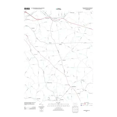
2013 Map of Saxonburg
USGS Topo · Published 2013About this map
The borough of Saxonburg anchors the southern portion of this Butler County landscape, showing its established grid at the intersection of Butler Rd and W Main St. This 2013 survey illustrates a region defined by a dense network of small unincorporated communities and family-named locales such as Frazier Mill, Jefferson Center, and Hannahstown. The terrain is deeply etched by numerous waterways, including Thorn Cr, Sarver Run, and Little Buffalo Cr, which shaped the early industrial and agricultural placement of these settlements. In the northeast, Carbon Center and Wadsworth sit along the Us-422 corridor, while the central hills are dotted with place names like Great Belt and Herman, reflecting the area's complex mosaic of local history and rural development.
Find a feature on this map
112 named features on this map. Tap any name to fly to it.
Don’t see what you’re looking for? This feature index may not catch every label — zoom into the map to look around manually.
Map Details
Editions of this 2013 Saxonburg Map
This is the sole edition of this map. No revisions or reprints were ever made.
Other maps of this area

1900 · Kittanning
USGS Topo · 1:62,500

1902 · Kittanning
USGS Topo · 1:62,500

1907 · Freeport
USGS Topo · 1:62,500

1908 · New Kensington
USGS Topo · 1:62,500

1909 · Freeport
USGS Topo · 1:62,500

1909 · Butler
USGS Topo · 1:62,500

1910 · New Kensington
USGS Topo · 1:62,500

1911 · Butler
USGS Topo · 1:62,500

1950 · Valencia
USGS Topo · 1:24,000

1953 · Pittsburgh
USGS Topo · 1:250,000