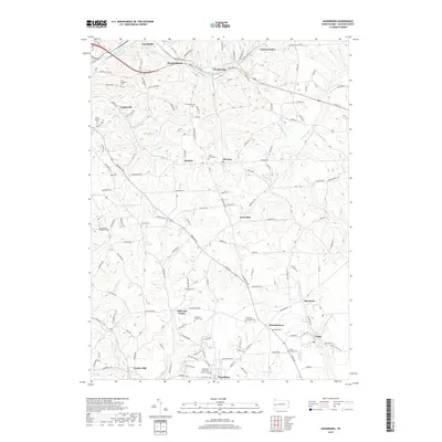
2019 Map of Saxonburg
USGS Topo · Published 2019About this map
Saxonburg stands at the heart of this landscape, surrounded by a network of rural settlements and family cemeteries that mark the agricultural and industrial foundations of Butler County. The terrain is defined by the winding paths of Thorn Creek and Rough Run, which carve through the countryside near historic locations like Frazier Mill. This survey illustrates the intricate layout of early transport routes, including Rte 422 E passing through Wadsworth and Carbon Center. Genealogists will find a concentration of burial sites such as Saint Marys Cem and B'nai Abraham Cem, reflecting the diverse cultural heritage of the area. From the monastery grounds at Holy Trinity Monastery Cem to the namesake waters of Bonnie Brook, the map provides a look at the enduring community structures of the late 20th century.
Find a feature on this map
160 named features on this map. Tap any name to fly to it.
Don’t see what you’re looking for? This feature index may not catch every label — zoom into the map to look around manually.
Map Details
Editions of this 2019 Saxonburg Map
This is the sole edition of this map. No revisions or reprints were ever made.
Other maps of this area

1900 · Kittanning
USGS Topo · 1:62,500

1902 · Kittanning
USGS Topo · 1:62,500

1907 · Freeport
USGS Topo · 1:62,500

1908 · New Kensington
USGS Topo · 1:62,500

1909 · Freeport
USGS Topo · 1:62,500

1909 · Butler
USGS Topo · 1:62,500

1910 · New Kensington
USGS Topo · 1:62,500

1911 · Butler
USGS Topo · 1:62,500

1950 · Valencia
USGS Topo · 1:24,000

1953 · Pittsburgh
USGS Topo · 1:250,000