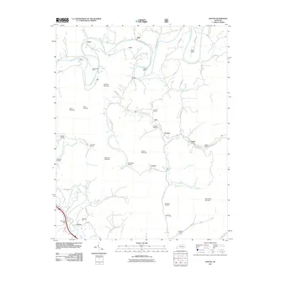
2011 Map of Saxton
USGS Topo · Published 2011About this map
The Cumberland River meanders through the northern reaches of this Whitley County landscape, carving dramatic oxbows at Horseshoe Bend and Maiden Bend. This 2011 survey captures a region defined by its narrow hollows and high ridges, where small communities like Gatliff, Nevisdale, and Packard are threaded along the creek valleys. The topography is dominated by significant elevations such as Patterson Mountain and Vanderpool Mountain, which separate the various drainage basins of Patterson Creek and Rose Creek.
Find a feature on this map
77 named features on this map. Tap any name to fly to it.
Don’t see what you’re looking for? This feature index may not catch every label — zoom into the map to look around manually.
Map Details
Editions of this 2011 Saxton Map
This is the sole edition of this map. No revisions or reprints were ever made.
Other maps of this area

1886 · Cumberland Gap
USGS Topo · 1:125,000

1888 · Cumberland Gap
USGS Topo · 1:125,000

1890 · Williamsburg
USGS Topo · 1:125,000

1891 · Cumberland Gap
USGS Topo · 1:125,000

1894 · Williamsburg
USGS Topo · 1:125,000

1952 · Wofford
USGS Topo · 1:24,000

1952 · Barbourville
USGS Topo · 1:24,000

1952 · Saxton
USGS Topo · 1:24,000

1952 · Rockholds
USGS Topo · 1:24,000

1952 · Williamsburg
USGS Topo · 1:24,000