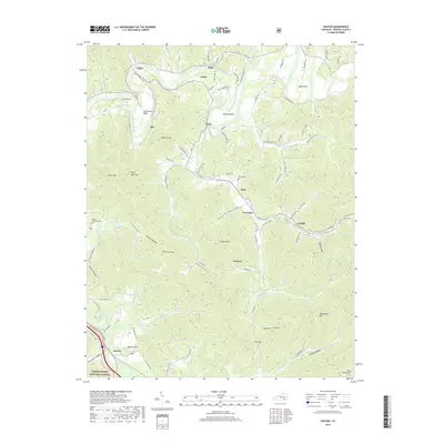
2019 Map of Saxton
USGS Topo · Published 2019About this map
Cumberland River meanders through the northern reaches of this Whitley County terrain, carving distinctive horseshoe-shaped features like Horseshoe Bend and Maiden Bend. The landscape is defined by the sharp ridges of Pine Mountain and numerous hollows, including Powers Hollow and Queener Hollow, which shaped the placement of local settlements and roads. This survey illustrates a network of small communities such as Gatliff, Nevisdale, and Packard that grew along the creek beds and mountain gaps. Genealogists will find a wealth of local landmarks, including family-named sites like Powers Cem and Siler Cemetary, along with landmarks like Bunkers Hill and Vanderpool Mtn. The southwestern corner is anchored by the Daniel Boone National Forest, showing the intersection of managed timberlands with the rural infrastructure of the Saxton area.
Find a feature on this map
100 named features on this map. Tap any name to fly to it.
Don’t see what you’re looking for? This feature index may not catch every label — zoom into the map to look around manually.
Map Details
Editions of this 2019 Saxton Map
This is the sole edition of this map. No revisions or reprints were ever made.
Other maps of this area

1886 · Cumberland Gap
USGS Topo · 1:125,000

1888 · Cumberland Gap
USGS Topo · 1:125,000

1890 · Williamsburg
USGS Topo · 1:125,000

1891 · Cumberland Gap
USGS Topo · 1:125,000

1894 · Williamsburg
USGS Topo · 1:125,000

1952 · Wofford
USGS Topo · 1:24,000

1952 · Barbourville
USGS Topo · 1:24,000

1952 · Saxton
USGS Topo · 1:24,000

1952 · Rockholds
USGS Topo · 1:24,000

1952 · Williamsburg
USGS Topo · 1:24,000