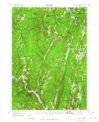
1957 Map of Saxtons River
USGS Topo · Published 1965About this map
The village of Grafton sits at the heart of this landscape, where the South Branch Saxtons River meets the main branch. The terrain is defined by a series of prominent ridges including Windmill Ridge and Hickory Ridge, which separate the river valleys where small settlements like Cambridgeport and Houghtonville developed. The Rutland railroad line tracks along the Williams River in the northeast, passing through Bartonsville and Brockways Mills, illustrating the vital rail-and-river connection that supported the local economy during the mid-20th century.
Find a feature on this map
103 named features on this map. Tap any name to fly to it.
Don’t see what you’re looking for? This feature index may not catch every label — zoom into the map to look around manually.
Map Details
Editions of this 1957 Saxtons River Map
3 editions found
Other maps of this area

1889 · Wilmington
USGS Topo · 1:62,500

1891 · Wilmington
USGS Topo · 1:62,500

1891 · Brattleboro
USGS Topo · 1:62,500

1893 · Wallingford
USGS Topo · 1:62,500

1893 · Brattleboro
USGS Topo · 1:62,500

1894 · Londonderry
USGS Topo · 1:62,500

1898 · Keene
USGS Topo · 1:62,500

1899 · Londonderry
USGS Topo · 1:62,500

1899 · Wilmington
USGS Topo · 1:62,500

1926 · Claremont
USGS Topo · 1:62,500