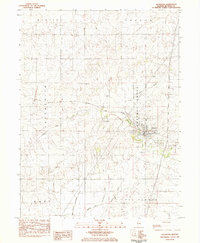
1983 Map of Saybrook
USGS Topo · Published 1983About this map
The Sangamon River winds through this McLean County landscape, framing the village of Saybrook as it appeared in the early 1980s. The settlement's layout is defined by the Norfolk and Western railroad corridor, which cuts an east-west path through Cheneys Grove. This area reflects a classic Illinois agricultural and transport hub, where the rail line intersects with local watercourses like Corn Valley Creek.
Find a feature on this map
17 named features on this map. Tap any name to fly to it.
Don’t see what you’re looking for? This feature index may not catch every label — zoom into the map to look around manually.
Map Details
Editions of this 1983 Saybrook Map
This is the sole edition of this map. No revisions or reprints were ever made.
Other maps of this area

1928 · Gibson City
USGS Topo · 1:62,500

1947 · Sibley
USGS Topo · 1:62,500

1949 · Sibley
USGS Topo · 1:62,500

1952 · Arrowsmith
USGS Topo · 1:62,500

1957 · Gibson City
USGS Topo · 1:62,500

1957 · Colfax
USGS Topo · 1:62,500

1958 · Peoria
USGS Topo · 1:250,000

1961 · Peoria
USGS Topo · 1:250,000

1963 · Peoria
USGS Topo · 1:250,000
1982 · Gibson City West
USGS Topo · 1:24,000