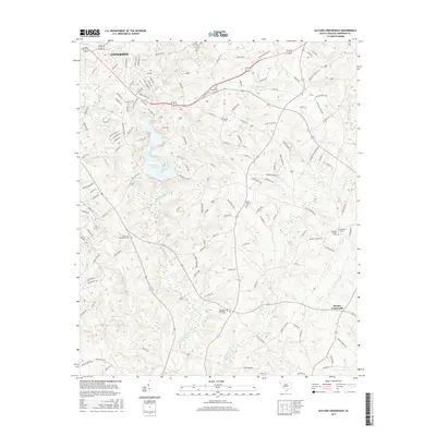
2017 Map of Saylors Crossroads
USGS Topo · Published 2017About this map
The waters of Rocky River and Broadway Lake dominate this portion of Anderson County, where the landscape is defined by the winding paths of Hencoop Creek and Tugaloo Cr. This survey captures the rural character of the region as it transitions from the southern edge of Anderson toward the community at Saylors Crossroads. The area is notably dense with localized history, marked by a series of long-standing religious landmarks and burial grounds that anchor the local genealogy.
Find a feature on this map
141 named features on this map. Tap any name to fly to it.
Don’t see what you’re looking for? This feature index may not catch every label — zoom into the map to look around manually.
Map Details
Editions of this 2017 Saylors Crossroads Map
This is the sole edition of this map. No revisions or reprints were ever made.
Other maps of this area

1888 · Pickens
USGS Topo · 1:125,000

1892 · Abbeville
USGS Topo · 1:125,000

1893 · Elberton
USGS Topo · 1:125,000

1894 · Pickens
USGS Topo · 1:125,000

1954 · Greenville
USGS Topo · 1:250,000

1957 · Anderson
USGS Topo · 1:62,500

1957 · Williamston
USGS Topo · 1:62,500

1958 · Greenville
USGS Topo · 1:250,000

1964 · Iva
USGS Topo · 1:24,000

1964 · Antreville
USGS Topo · 1:24,000