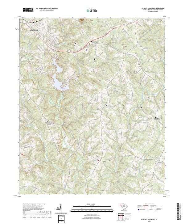
2024 Map of Saylors Crossroads
USGS Topo · Published 2024About this map
Anderson and the surrounding rural communities of Anderson County are defined by a complex network of waterways feeding into the Rocky River. This modern survey illustrates the persistent agricultural and residential character of the landscape, where long-standing church graveyards serve as anchor points for local history. Distinctive landmarks such as the Neals Creek Baptist Church Graveyard and the Bethlehem United Methodist Church Graveyard highlight the area's deep-rooted community foundations. The central reach of Broadway Lake dominates the central topography, formed by the convergence of Broadway Creek and Neals Creek. To the southeast, the small community at Saylors Crossroads sits near the headwaters of Hencoop Creek and Bear Creek. Genealogists will find significant value in the numerous family burial sites and smaller plots like the Mcfall Cem and Williamson Family Cem, which are clearly marked alongside modern roads and legacy property lines.
Find a feature on this map
171 named features on this map. Tap any name to fly to it.
Don’t see what you’re looking for? This feature index may not catch every label — zoom into the map to look around manually.
Map Details
Editions of this 2024 Saylors Crossroads Map
This is the sole edition of this map. No revisions or reprints were ever made.
Other maps of this area

1888 · Pickens
USGS Topo · 1:125,000

1892 · Abbeville
USGS Topo · 1:125,000

1893 · Elberton
USGS Topo · 1:125,000

1894 · Pickens
USGS Topo · 1:125,000

1954 · Greenville
USGS Topo · 1:250,000

1957 · Anderson
USGS Topo · 1:62,500

1957 · Williamston
USGS Topo · 1:62,500

1958 · Greenville
USGS Topo · 1:250,000

1964 · Iva
USGS Topo · 1:24,000

1964 · Antreville
USGS Topo · 1:24,000