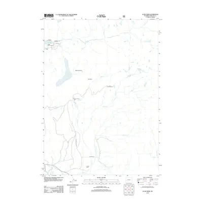
2012 Map of Scab Creek
USGS Topo · Published 2012About this map
Boulder Lake Ranch and Mountain Springs Ranch anchor this landscape in Sublette County, where the high-altitude drainage systems feed the E Fork River. The terrain is defined by glacial features and remote basins, including Hall Basin and the aptly named Moonshine Park. This 2012 survey illustrates the transition from the low-lying Silver Cr up toward the high peaks and alpine water bodies like Soda Lake and the Toboggan Lakes. Recreation and access are concentrated at sites such as Boulder Lake Campground and Scab Creek Campground, which serve as gateways to the surrounding wilderness. Notable landmarks like Steele Hot Springs and the prominent Lovatt Butte provide distinct points of interest for those studying the regional topography and local ranching history.
Find a feature on this map
28 named features on this map. Tap any name to fly to it.
Don’t see what you’re looking for? This feature index may not catch every label — zoom into the map to look around manually.
Map Details
Editions of this 2012 Scab Creek Map
This is the sole edition of this map. No revisions or reprints were ever made.
Other maps of this area

1938 · Mt Bonneville
USGS Topo · 1:62,500

1941 · Mt Bonneville
USGS Topo · 1:62,500

1942 · Mt Bonneville
USGS Topo · 1:62,500

1955 · Lander
USGS Topo · 1:250,000

1958 · Lander
USGS Topo · 1:250,000

1961 · Lander
USGS Topo · 1:250,000

1964 · Fremont Butte
USGS Topo · 1:24,000

1964 · Boulder Lake
USGS Topo · 1:24,000

1964 · Boulder
USGS Topo · 1:24,000
1968 · Fayette Lake
USGS Topo · 1:24,000