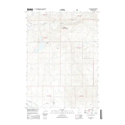
2015 Map of Scab Creek
USGS Topo · Published 2015About this map
Bridger National Forest dominates this Wyoming landscape, where the high country drops toward the East Fork River valley. The terrain is defined by a series of named basins and landmarks such as Hall Basin, Moonshine Park, and the prominent Lovatt Butte. This 2015 survey reflects a region primarily managed for conservation and recreation, characterized by an intricate drainage system including Scab Cr, Lovatt Cr, and Divide Cr flowing through deep cuts like Boulder Canyon.
Find a feature on this map
30 named features on this map. Tap any name to fly to it.
Don’t see what you’re looking for? This feature index may not catch every label — zoom into the map to look around manually.
Map Details
Editions of this 2015 Scab Creek Map
This is the sole edition of this map. No revisions or reprints were ever made.
Other maps of this area

1938 · Mt Bonneville
USGS Topo · 1:62,500

1941 · Mt Bonneville
USGS Topo · 1:62,500

1942 · Mt Bonneville
USGS Topo · 1:62,500

1955 · Lander
USGS Topo · 1:250,000

1958 · Lander
USGS Topo · 1:250,000

1961 · Lander
USGS Topo · 1:250,000

1964 · Fremont Butte
USGS Topo · 1:24,000

1964 · Boulder Lake
USGS Topo · 1:24,000

1964 · Boulder
USGS Topo · 1:24,000
1968 · Fayette Lake
USGS Topo · 1:24,000