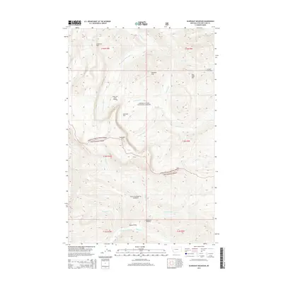
2014 Map of Scapegoat Mountain
USGS Topo · Published 2014About this map
Scapegoat Mtn and the Lewis and Clark Range dominate this high-elevation wilderness where the Lewis & Clark National Forest and Lolo National Forest meet. The terrain is defined by a significant hydrographic divide, with the Dearborn River and S Fork Sun River draining the northern and central slopes while the N Fork Blackfoot River collects from the southern reaches. High-altitude meadows and valleys like McDonnell Meadow, Tobacco Valley, and Halfmoon Park provide natural breaks in the steep topography, which includes notable landmarks such as Cigarette Rock and Red Slide Mtn. The map traces the intricate network of tributaries including Telephone Cr, Cave Cr, and Straight Cr, flowing from passes such as Straight Creek Pass. This survey documents a critical intersection of protected forest lands at the crest of the continental divide, where natural features remained the primary landmarks long into the twenty-first century.
Find a feature on this map
35 named features on this map. Tap any name to fly to it.
Don’t see what you’re looking for? This feature index may not catch every label — zoom into the map to look around manually.
Map Details
Editions of this 2014 Scapegoat Mountain Map
This is the sole edition of this map. No revisions or reprints were ever made.
Other maps of this area

1903 · Coopers Lake
USGS Topo · 1:125,000

1955 · Choteau
USGS Topo · 1:250,000

1957 · Choteau
USGS Topo · 1:250,000

1958 · Choteau
USGS Topo · 1:250,000

1962 · Choteau
USGS Topo · 1:250,000

1968 · Heart Lake
USGS Topo · 1:24,000

1968 · Olson Peak
USGS Topo · 1:24,000
1968 · Lake Mountain
USGS Topo · 1:24,000
1970 · Scapegoat Mountain
USGS Topo · 1:24,000
1970 · Jakie Creek
USGS Topo · 1:24,000