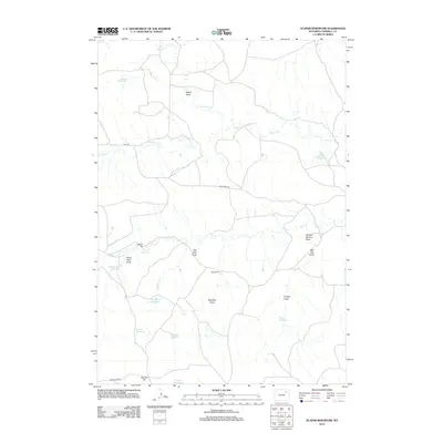
2012 Map of Scaper Reservoir
USGS Topo · Published 2012About this map
Caballo Cr and Bluegate Cr course through this high plains drainage system in Campbell County, where the landscape is defined by its collection of small-scale water management features and surface mining activity. The map reveals an intricate network of draws, such as School Section Draw, Red Top Draw, and Thielen Draw, which channel intermittent flows toward scattered catchments like Scaper Reservoir and Moser Reservoir. This 2012 survey documents the industrial footprint of the region through labeled pits including Tammy Pit, Cattail Pit, and Old Well Pit. The distribution of these features alongside roads like Bell Rd and Hoe Creek Rd illustrates a rural economy reliant on water retention and mineral extraction. Genealogists and local historians can use the named features, such as Dayton Reservoir and Romaker Reservoir, to locate specific family-linked land tracts and historical ranching boundaries in this part of Wyoming.
Find a feature on this map
26 named features on this map. Tap any name to fly to it.
Don’t see what you’re looking for? This feature index may not catch every label — zoom into the map to look around manually.
Map Details
Editions of this 2012 Scaper Reservoir Map
This is the sole edition of this map. No revisions or reprints were ever made.
Other maps of this area

1954 · Gillette
USGS Topo · 1:250,000

1955 · Newcastle
USGS Topo · 1:250,000

1955 · Gillette
USGS Topo · 1:250,000

1958 · Gillette
USGS Topo · 1:250,000

1958 · Newcastle
USGS Topo · 1:250,000

1959 · North Star School
USGS Topo · 1:62,500

1962 · Gillette
USGS Topo · 1:250,000

1971 · Scaper Reservoir
USGS Topo · 1:24,000

1971 · The Gap SW
USGS Topo · 1:24,000
1971 · Pleasantdale
USGS Topo · 1:24,000