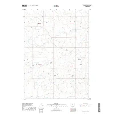
2017 Map of Scaper Reservoir
USGS Topo · Published 2017About this map
Scaper Reservoir and a network of catchments define this pocket of Campbell County, where the high plains landscape is carved by seasonal drainages and draws. The terrain is marked by numerous man-made features that reflect the ranching and resource-extraction heritage of the area, including Cattail Pit and Tammy Pit. The hydrography of the region relies on these scattered reservoirs, such as Moser Reservoir and Worth Reservoir, which capture runoff from ephemeral streams like Bluegate Cr and Caballo Cr. These water sources are vital in a landscape dominated by topographic depressions like School Section Draw and Moser Draw. Local navigation follows established routes including Bell Rd and Hoe Creek Rd, which traverse the undulating terrain of the northern Powder River Basin. This survey provides a clear view of the rural infrastructure and land use patterns that characterize this part of Wyoming.
Find a feature on this map
30 named features on this map. Tap any name to fly to it.
Don’t see what you’re looking for? This feature index may not catch every label — zoom into the map to look around manually.
Map Details
Editions of this 2017 Scaper Reservoir Map
This is the sole edition of this map. No revisions or reprints were ever made.
Other maps of this area

1954 · Gillette
USGS Topo · 1:250,000

1955 · Newcastle
USGS Topo · 1:250,000

1955 · Gillette
USGS Topo · 1:250,000

1958 · Gillette
USGS Topo · 1:250,000

1958 · Newcastle
USGS Topo · 1:250,000

1959 · North Star School
USGS Topo · 1:62,500

1962 · Gillette
USGS Topo · 1:250,000

1971 · Scaper Reservoir
USGS Topo · 1:24,000

1971 · The Gap SW
USGS Topo · 1:24,000
1971 · Pleasantdale
USGS Topo · 1:24,000