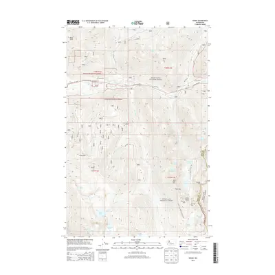
2014 Map of Scenic
USGS Topo · Published 2014About this map
Snoqualmie National Forest and Wenatchee National Forest converge in this high-elevation corridor where the Tye River and heavy rail infrastructure dominate the valley floor. The settlement of Scenic serves as a critical point for the Great Northern Railway heritage, positioned at the mouth of the New Cascade Tunnel and the older Cascade Tunnel. This map highlights the complex engineering required to navigate the Cascades, showing the winding paths of the Stevens Pass Hwy and the historic Old Cascade Hwy.
Find a feature on this map
53 named features on this map. Tap any name to fly to it.
Don’t see what you’re looking for? This feature index may not catch every label — zoom into the map to look around manually.
Map Details
Editions of this 2014 Scenic Map
This is the sole edition of this map. No revisions or reprints were ever made.
Other maps of this area

1902 · Skykomish
USGS Topo · 1:125,000

1905 · Skykomish
USGS Topo · 1:125,000

1957 · Wenatchee
USGS Topo · 1:250,000

1965 · Captain Point
USGS Topo · 1:24,000

1965 · Evergreen Mtn
USGS Topo · 1:24,000

1965 · Stevens Pass
USGS Topo · 1:24,000

1965 · Mount Daniel
USGS Topo · 1:24,000

1965 · Skykomish
USGS Topo · 1:24,000
1965 · Big Snow Mtn
USGS Topo · 1:24,000
1965 · Scenic
USGS Topo · 1:24,000